- J Euclide’s walk to the SPRR . . . 8
- 607 Ryan . . . 3.5
- Ryan beyond Mill . . . 4
- Toward the lake . . . 4
- Waterfront wharfs and warehouses . . . 5.5
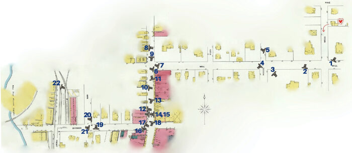
It was such a joy to find so much visual information about the houses and neighborhoods the Champagnes lived in from the Sanborn maps; the physical shape and layout of the buildings, where rooms stuck out with gables, ‘L’s, and hexagonal bay windows, and verandahs… the purpose marked, and their layout amongst each other on the block. But I never would have guessed that an unusual history-loving woman born in 1882 named Maude Reid would collect and caption a wealth of photos of Lake Charles’ early years, including Tisolay’s, then donate them to an institute that, 100 years later, would put them online for me to find with a click of a button while sitting in the living room of my home in the Oregon forest. Thousands of photographs, so many that I could reconstruct at least 3 paths I knew the family would take that first week with photos and see much of what they saw, as though I were silently walking with them. J Euclide would have checked in with his new job at the Southern Pacific Railroad freight depot. Tiwazzo and the girls would’ve checked out Ryan St’s 4-block shopping strip. And that first Sunday, the family would’ve gone to Mass at the Immaculate Conception church at the end of the 4 blocks of shops and stores Tiwazzo and the girls were probably well familiarized with by now, maybe treating themselves to a short streetcar ride. After Mass, they likely would’ve taken a nice stroll around the town square and waterfront in front of the church, and the ferry landing a block over, and maybe walked home by way of the magnificent Broad St mansions. The depth of my gratitude to the cosmos for this photo collection . . . no words.
When J Euclide took his first walk to the freight depot to let his new employers know that he had arrived in town, he knew nothing about the homes he passed on his 3 block walk down Mill St to the town’s main drag, Ryan St, or the people in them. He just saw the houses, perhaps a few children outside, women rocking on their front porch, men driving past in horses and buggies. Housekeepers and hired men doing chores in the back yards, barns, animals pens, vegetable gardens, etc. could have been local African-American Creoles freed from slavery 40 years before but still reeling from the financial disenfranchisement of post-slavery Jim Crow and Reconstruction. Or they could have been newly-arrived immigrants from Europe. If he heard these people talking as he walked by, he’d have heard English with Danish German accents more often than he heard his own Cajun French.
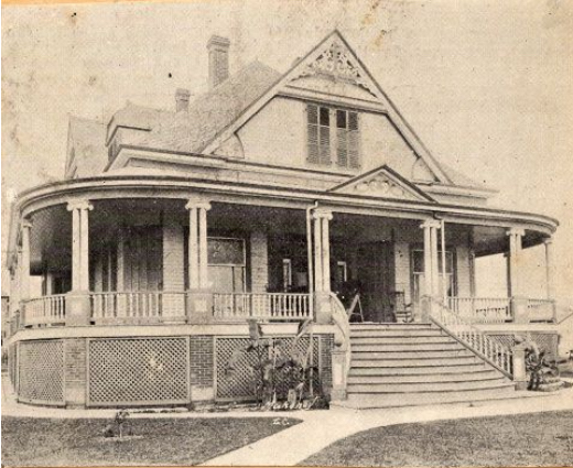
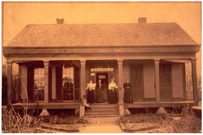
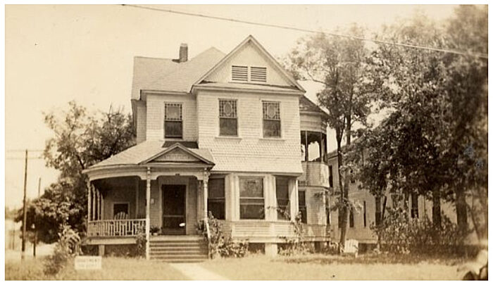
On the first corner he came to, he saw two of the most magnificent homes in Lake Charles.
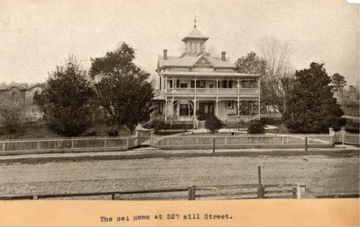
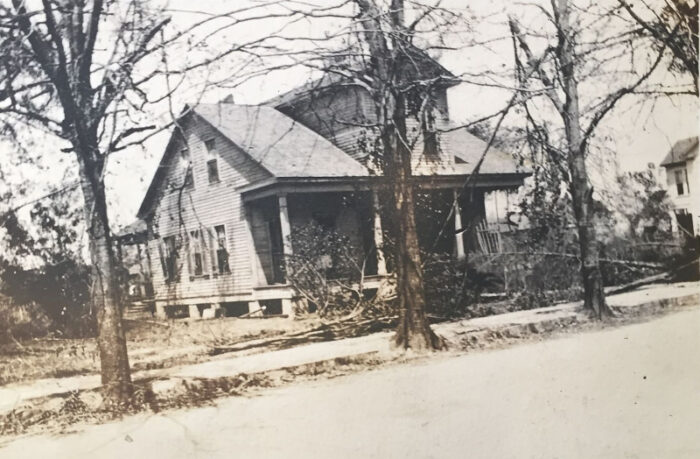
In the right side of the photo of the Bel mansion, the 2-storey Champagne home can be seen vaguely through bare tree branches between the Bell house and a large magnolia tree.
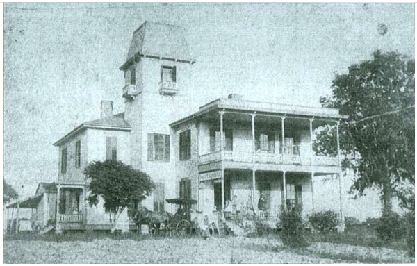
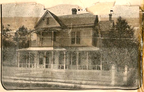
Rounding that corner onto Mill St, he would’ve seen another big fine home with a mansard-roofed tower on grounds that took up a quarter of the block. He might have noticed the sign hanging from the balcony that read ‘Hayes House’ and guessed, correctly, that it was a boarding house. A block further down, he might have heard a singing voice in the middle of a lesson coming from a more modest home I don’t have a picture ofwhich he’d guess, correctly, might be the home of a music teacher.
All he knew was what he could see, a wide-open neighborhood with lots of open green spaces where forests had only been cleared for building within the past 15 years. Homes ran the gamut between magnificent mansions, fine two-storey homes with verandas across the front, and tidy wooden cottages with a half-story in the attic and wrap-around porches, all built of the locally milled pine. The massive moss-draped oaks seen today in Lake Charles were small, most only as old as the houses they’d been planted for.
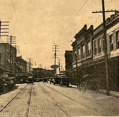
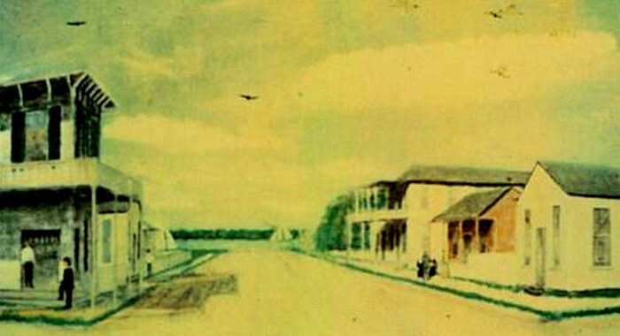
Turning left on Ryan St, the town’s main drag, he knew nothing of the stores and businesses he passed other than what he could see in the windows and read on the signs. But he could see that it wasn’t as busy as it was a few blocks further south where the business and civic hub was. Perhaps he sensed that Ryan St was in a state of transition.
Old wood-frame cottages and barns and sheds with little family-owned stores and offices on the same lot had been built in the 50s & 60s from the local lumber that made the town its fortune. By the time J Euclide saw them, they were in varying degrees of deterioration and collapse. One by one, they were being replaced by 2-story, red-brick commercial buildings wide enough for several businesses in a row, with storefronts at street level and offices, warehouses, or meeting halls above.
As the town spread eastward from Ryan, away from the lake, first to Bilbo, then to Hodges, it took family residences with it, as well as the all-purpose, family-centered feel of a neighborhood with open green spaces and fenced-in yards. It was giving way to commercial use that limited the view of what was behind the wide-spread buildings to the occasional alleyway.
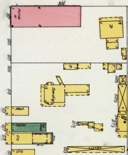
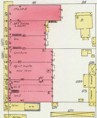
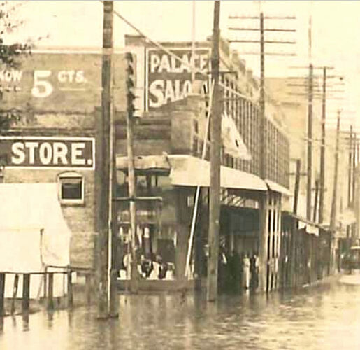
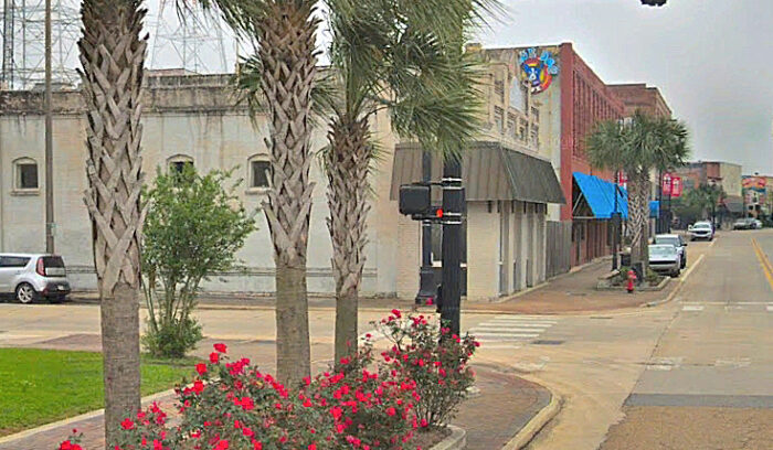
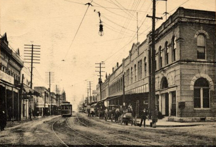
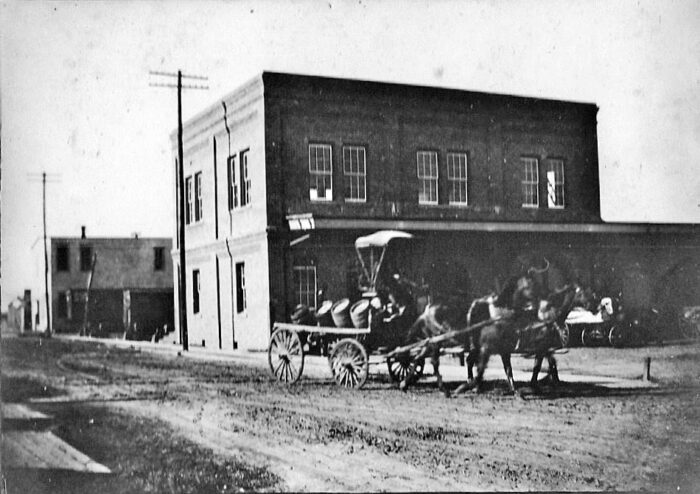
Most of the old wooden structures seen on Sanborn’s 1903 map had been replaced by 1909, but there’s no way of knowing which ones had or hadn’t been by 1907, when J Euclide took his first walk down the 600 block of Ryan St. The only one I know he saw was the long, single-story, brick corner store, at his immediate left as he turned. Whether it was the furniture store seen on the 1903 Sanborn map or the 5¢-and-10¢ store shown on the 1909 map (Meyer’s Variety Store) is anyone’s guess, since businesses seem to have been in as much transition as the structures they were in. You can see Meyer’s Variety Store at the far left of photo 9, below, most of its sign hidden behind the tree in the Gallaghers’ front yard.
Behind the variety store, you can also see the brick commercial row building immediately south of it, sporting a Palace Saloon sign above the first in the row.
~~~~~~~ 607 Ryan ~~~~~~~
In a stroke of luck that has great meaning to me, the lot on which that brick row building stood was represented on Sanborn maps or photographs several times across 3 decades.
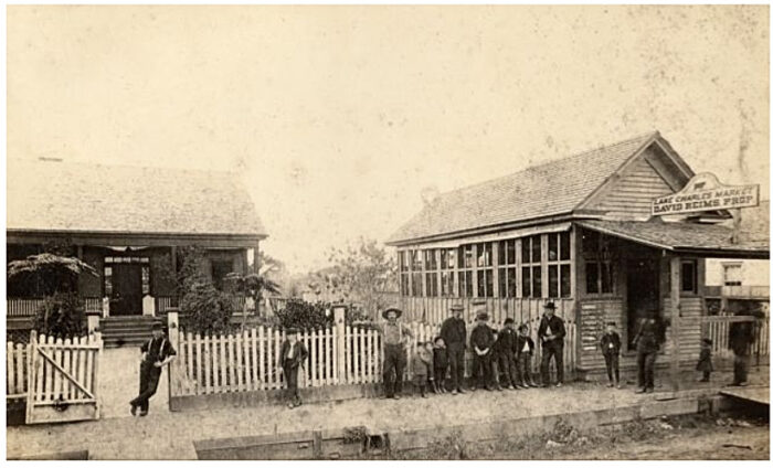
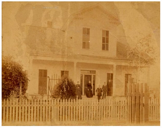
The earliest was a photo from the late 1880s and shows the little wood-frame cottage of David Reims set back behind a tidy garden, and his butcher shop up by the sidewalk where the family is lined up. In Sanborn’s 1903 map, the house, in its last incarnation, can be seen just below the brick corner store, labelled as a boarding house.
[*aside* – Reims bought the house from Peter Bruderson, who built it in the late 1870s, but soon left with his young wife for Oregon. We’ve met him before in the previous post, part 2 of “The Route Home”, the son-in-law of the irascible Judge David John Reid, Miss Maude’s grandfather, whom we’ve talked about in all the Lake Charles posts. Bruderson helped build the home of his brother-in-law, the newly-widowed William Hutchins, called Capt. Willy, who had also married a daughter of Judge Reid’s, during a building spree that saw the Reid brothers diving into a sequence of construction projects. Perhaps it was a way to manage their grief over the death of their much-beloved oldest sister Eugenie, who was Hutchins’ 35-yr-old wife and mother to his 8 children (the 8th joining his mother in death). Or maybe it was simply that the bossy, hot-tempered old Judge, also recently deceased, had finally freed his boys to do things their way. In any case, finishing the Hutchins home was the last act of Bruderson before selling his home to Reims and moving his family to Oregon.]
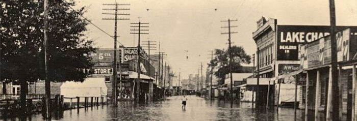
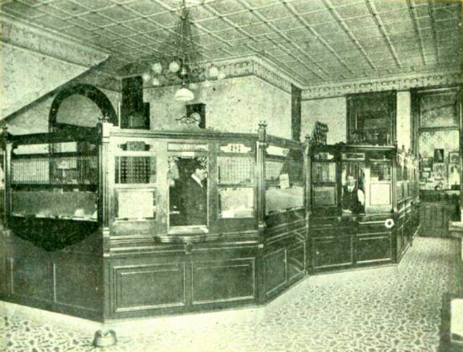
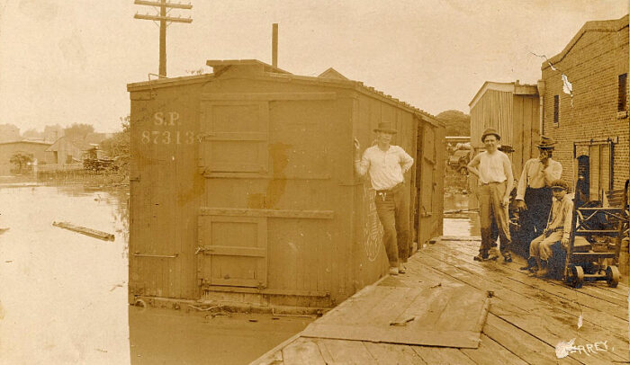
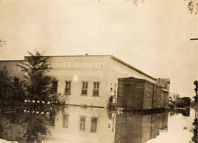
The later photos of the Ryan/Mill intersection were taken professionally, part of a series to document the devastating 1913 flood. Just the year before, in the same brick building that replaced the Reims homestead, a couple doors past the Palace Saloon, Tisolay’s aunt Mathilde Bourdier (Tiwazzo’s sister) had opened a men’s furnishings store with the money from the suit she won against the Southern Pacific Railroad for her husband’s wrongful death. The newly widowed Mathilde, with little Mildred, had left her home in the rural outskirts of Lake Charles and moved to town where she and her sister Alicia’s family rented a big 2-story house at 617 Moss St, a block down from where the Champagnes had first lived. She partnered with the Champagnes in business as well, taking J Euclide (who quit his railroad freight job) and his oldest daughter Marie-Beulah into the business she named Bourdier and Co. Men’s Furnishings Store.
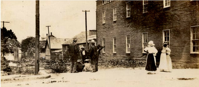
If ever there were a photo that captured an ill omen, it would be photo 11, taken during the 1913 flood which I think J Euclide saw ‘live and in color’ on that wet Wednesday in October.
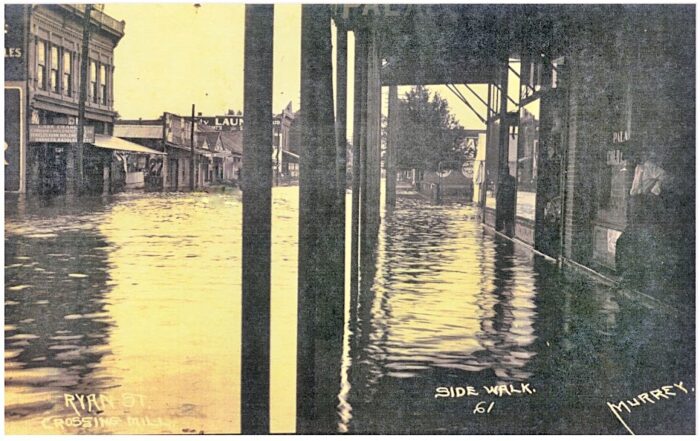
J Euclide was surely at the store, possibly with Mathilde, keeping a worried watch on the rising Calcasieu River waters that kept pushing inland through the streets, picking everything they could up off the floors and moving merchandise to higher shelves. It’s possible he periodically went outside to stand silent vigil over the rising water like the man at far right. Actually, it’s entirely possible that J Euclide is in this moment that the photo captured, standing shin-deep in water just out of view to the photographer’s right, because as it happens, the photographer set his camera up directly in front of Bourdier and Co.
The man at far right is standing in a doorway beside a store window that can just barely be read, ‘Palace Cold Drinks’. If this brick building had been built by 1907 and J Euclide saw it as he was walking to the freight depot, that window would have read ‘Palace Saloon’ the same as the big sign painted on the exterior of the building, high up in the front corner. Changing the name of saloons to cafés and such wouldn’t come about until the following year, when Prohibition was voted in. The fact that no one bothered to paint the new name over the outside sign in the 5 years between the vote and the flood photos may reflect the lackadaisical view that Lake Charles, like much of urban America, took of enforcing prohibition laws.]
I doubt J Euclide would’ve worried much about having to evacuate his family from their home. The town’s flooding extended well beyond the Moss St house, but only in the streets. Google Earth’s elevation stats today suggest that the Champagne house sits on land a good 4 feet higher in elevation than the store, which is 3 blocks closer to the lake. Since the streets were flooded, though, businesses and schools were closed. And if the photographer’s many photos are any indication, the kids were playing in the water, some gingerly in their regular day clothes, some in their swimming outfits, fully invested, and some in canoes and small paddle boats. Knowing Tisolay, I can see her, now 8, playing in the water, possibly with her family but more likely with Karl Krause and Bernard Levy, one of whom would surely have had a rowboat or canoe of some kind. My image of her sitting in the middle of the boat while the boys got in and out, pushing and pulling her through places in the street where they knew the water would be the deepest, is so acute, it’s almost like she’s telling me that my imagination got this one ‘spot-on’.
~~~~~~~ Ryan beyond Mill ~~~~~~~
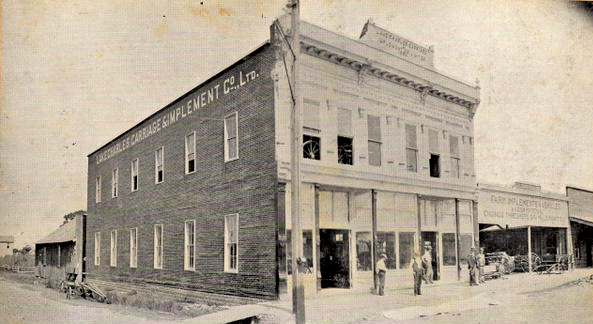
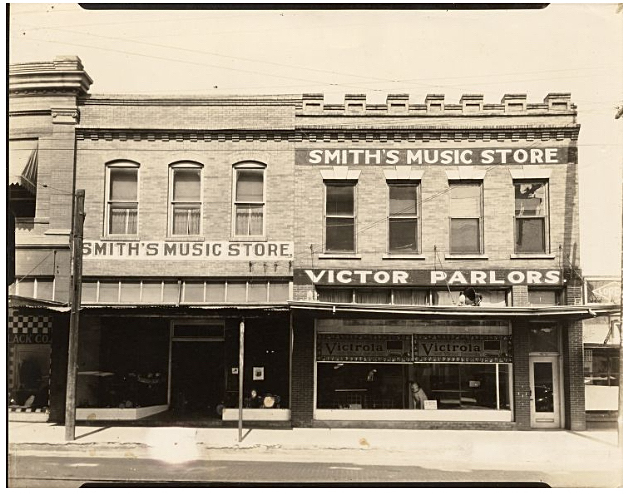
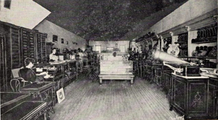
Anyway, returning to our hero frozen in mid-stride, passing whichever building, wooden or brick, was on the 605-619 Ryan lot, J Euclide would have noticed that there were many tailors and barber shops, as well as a cobbler, just in that one block. The agricultural and livery businesses were plentiful as well, from implement stores, carriage and wagon warehouses for the big store he’d seen in the previous block, hay and feed stores, and harness shops. There were several groceries, a few meat markets and seafood stores, and a fruit stand. And this was all just in that one block. And during those years between 1903 and 1909, Adolph Meyer’s drug store (separate from the 10¢ store), Smith’s music store, a jewelry and watch shop, a hand printing shop, a wall paper and paint store, and a small restaurant might have made their appearance in time to greet J Euclide’s first walk. And of course, saloons.
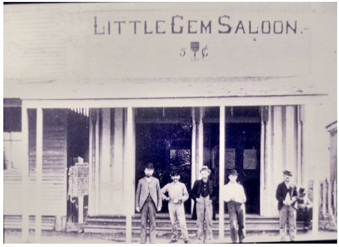
Shortly before turning again toward the lake onto the last block of Division St, he saw the Little Gem Saloon, which would be taken over by a harness store within a year, after the Prohibition vote. I don’t know if harness shops and such made J Euclide pine for his treasured racing trotter back in Breaux Bridge, which I suspect he may have had to leave behind. But in a town where everything was within a 6 block walk, he probably didn’t have enough need for a horse to offset the expense of keeping it. Good news for the children, though, which he couldn’t yet know; the saloon to the left of the Little Gem would soon be a bicycle shop, and the one on the corner that he was about to turn away from would become a confectioner and ice cream parlor. The best news for the Champagne family, though, and my Tisolay in particular, either already existed or would soon, and would be there through all the years the Champagnes were in Lake Charles, right across the street from the Little Gem…. Smith’s Music store.
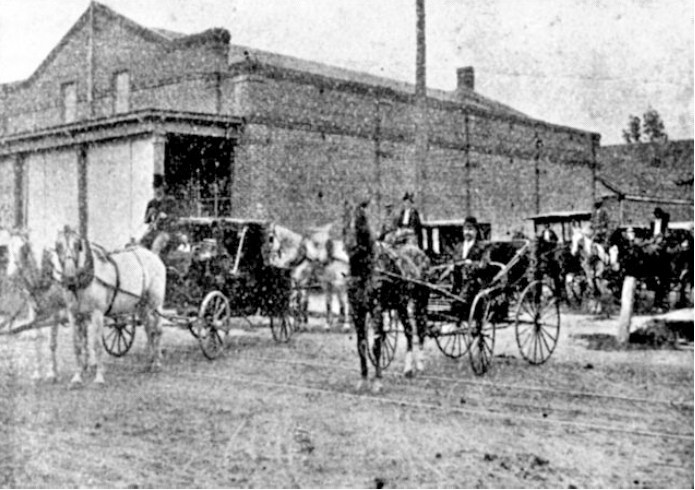
Behind the saloon on the corner, if he’d glanced back down Mill before turning toward the lake, he’d have seen the livery of Gill and Trotti, and their undertaking business next door.
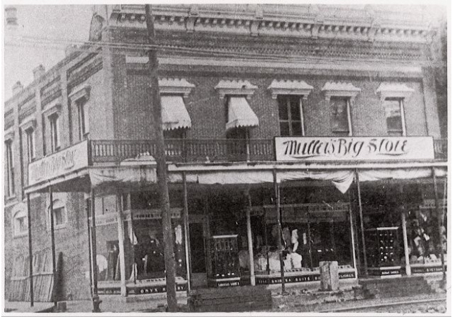
Rounding the corner, across the side street from the funeral home, J Euclide would’ve seen Muller’s Big Store whose owner bought the beautiful Reid home on Hodges that Miss Maude grew up in. Then he’d have passed the First Nat’l Bank with its fine chiseled stone arches, often called the Stone Bank.
~~~~~~~ Toward the Lake ~~~~~~~
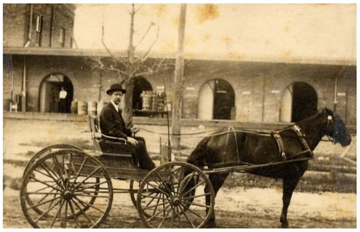
Turning onto the last block of Division before the lake, J Euclide again saw homes whose owners he knew nothing about and offices whose names didn’t mean anything to him. But thanks to the owner of the one across the street from the SPRR freight depot, fire chief Dick Gunn, and his desire for a picture of himself with the horse and carriage he raced to fire scenes with, we have a nice view of where J Euclide first worked in Lake Charles, the destination of his walk.
~~~~~~~ waterfront wharfs and warehouses ~~~~~~~
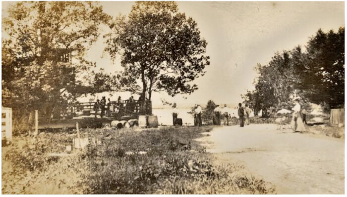
The ferry Hazel is seen at left, 2 blocks north of Division St, at the foot of Pine St, flooded out of its usual landing at Pujo St., 4 blocks further south. Lake Charles was quite accustomed to the Calcasieu overflowing its banks, but not to the extent it did in 1913. Hopefully, the boat has jury-rigged a set of planks as a ramp for the passengers to cross on.
The lakefront at Pine St had no waterfront warehouses or wharfs, and didn’t look industrial, but it was no longer residential either ever since railroad tracks had been installed for the spur that ran south to the Pujo St wharf. The photographer, who is standing on the tracks, was the civil engineer who photo-documented the town’s flooding, and the woman and baby in a pram, at right, are his wife and child.
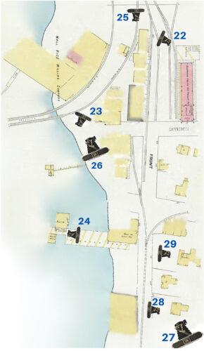
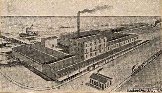
From where J Euclide stood at the freight depot, though, he would have seen the wharfs of both Division and Broad St, since the two streets almost converged there, and big warehouses with loading docks, as well as a spaghetti bowl of tracks where railroad spurs fanned out alongside warehouse platforms that mostly belonged to wholesale grocery brokers. The biggest, Wall Rice Mill, had twin railroad spurs that passed in front of its loading dock and then turned onto trestles over the water for about 100 ft. He may have seen schooners docked at one of the wharfs, or many, with outgoing sacks of rice and piles of lumber lined up waiting to be loaded, and incoming crates of incoming cargo stacked up on the wharf waiting to be warehoused, all by men with dollies and mule-drawn wagons in a buzz of activity.
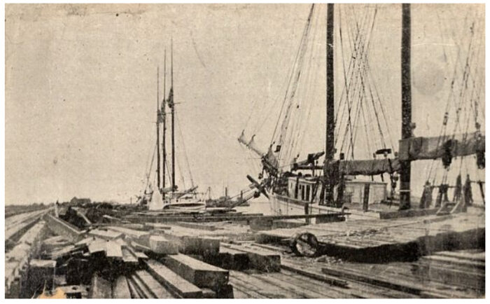
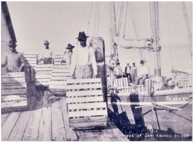
Far out on the lake, he might have seen the white sails of schooners passing the Division St whatf, bound instead for the lumber mills farther upriver, riding high and empty coming in from the Gulf, or low and laden going back out, most bound for Galveston, Lake Charles’ gateway to the West. Old photos make us forget the greens and blues of the water, the sky’s reflection in it, and the lush pine forest all around the lake, as well as the white seagulls and canvas sails gliding by on sea and air.
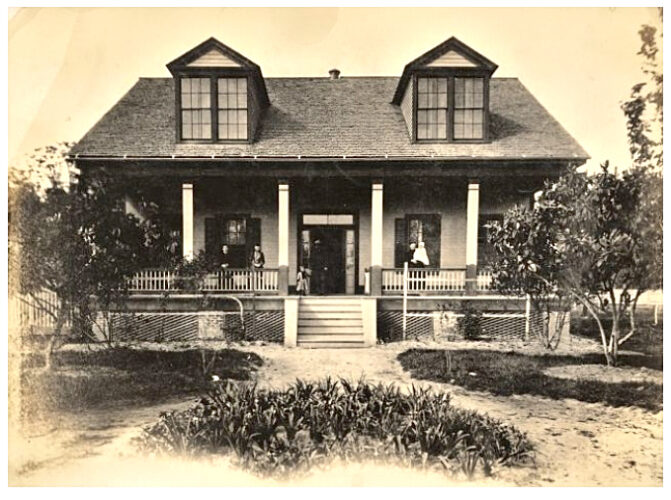
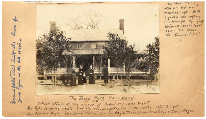
Something else J Euclide would have seen makes me green with envy. There were several early pioneer homes facing the lake, which now faced the Division and Broad St wharfs, throwbacks to the days of early settlement before the lakefront’s industrialization, and one of them was that of the town’s founding father, Jacob Ryan, built in the 1840s.

Very soon, possibly the same day, Tiwazzo and the girls, together with baby Stella (my Tisolay) would have taken a similar walk to find where to get their most immediate needs, including food. They’d have seen the same stores along the 600 block of Ryan that J Euclide had, noting the groceries and markets, and maybe the music store, and perhaps paying more attention to a furniture store than J Euclide had. But they’d have continued down Ryan for the whole 4-block strip of stores that ended where the church, city hall and courthouse clustered into something of a civic center.
~~~~~~~ (cont’d on the next post) ~~~~~~~
================================================================================