… (cont’d from pg.2 of 4)
__________________________
The significance of Port Royal to me as the Mecca, the ground zero, for all Acadians and Cajuns and the tie that this place represents, binding me to my grandmother, is hard to describe.
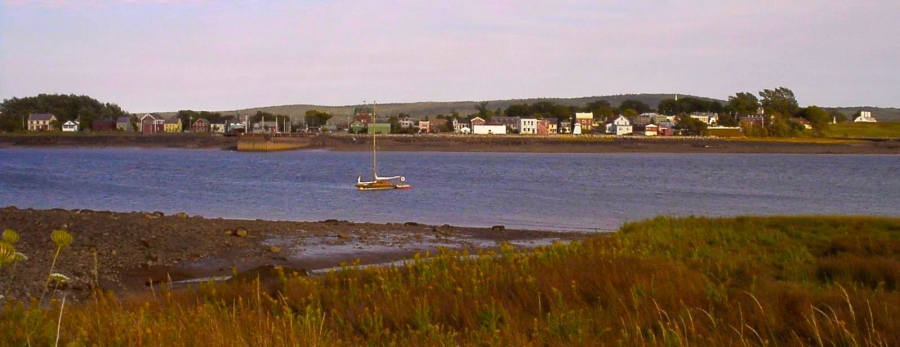
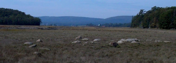
Port Royal, populated by the first shiploads of French settlers in 1636, lay at the mouth of the Annapolis River, sheltered by the Annapolis Basin at the south entrance of the Bay of Fundy. The waters there, where they have barely begun their famous rush up the bottleneck of the Fundy Basin toward the red-clay tributaries at its head, are still the crystalline green of the ocean. Those settlers built their homes and cultivated the floodplain along a 15 mile stretch of the Annapolis River north of the town proper, and I knew every curve and meander of that river valley settlement like the back of my hand from a 1671 map drawn by the census taker. It was one of my favorite documents.
.
Along with the names, ages and occupations of the settlers in the 35 yr old colony, the census taker had drawn a map of every curve and salt marsh along the river’s floodplain, marking an ‘x’ at the base of the foothills wherever he found a house, drawing lines in the floodplain for the dikes wherever cultivated fields had been carved from the surrounding salt marsh, and identifying family compounds by head of the household. He also marked where there was a mill, an orchard, and a “mass house” – probably an unsanctified version of a church where, absent a priest, the settlers held religious gatherings themselves. But now K and I were finally here. I could look up from the map and walk the lands myself, this strip of river valley where the Acadian culture first evolved.
.
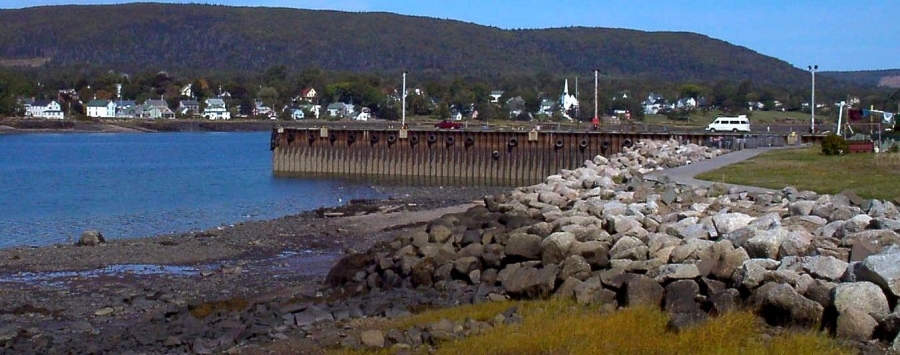
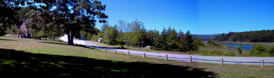
I drove through the picturesque little town of Port Royal several times just getting my bearings, knowing it would be home base for me for the summer, and picked a spot at the end of a big commercial wharf for my first night there, sticking way out into the river where I could look back at the town with its fort which, though eventually British, started out French in 1634.
.
.
__________________________
.
.
.
.
.
.
.
.
.

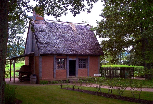
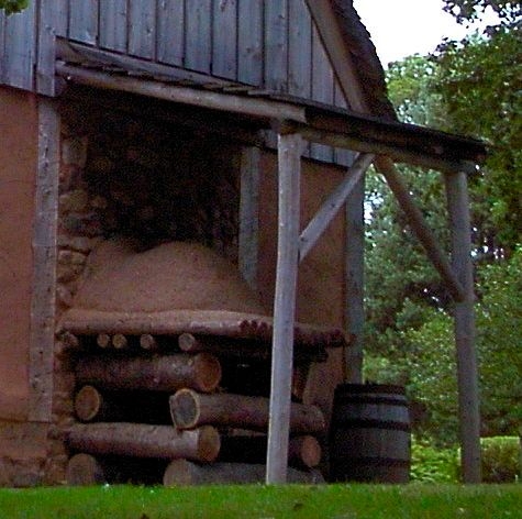
A day spent at Fort Anne and the Annapolis Royal Historic Gardens was much more informative than I had expected. Two reproductions of an Acadian house and an aboitteau, as well as all the garden plots and plantings, were designed solely on the findings of the national and provincial government archaeologists, whose holdings and archives I’d just been given such sumptuous access to in Halifax. (The Canadian government knows how to support its archaeologists.) The garden information was apparently aided further by information from diaries of the time, which I didn’t know existed.
.
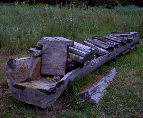
As long as I’m giving you these visuals of Acadian life, I may as well give you one last one (since this page is about K and our adventures, not the Acadians). The best Acadian cellar site I ever found I found during these first few days in Port Royal, driving north of town, back and forth along the course of the census taker’s map. Being up near the road, too close to be part of the cultivated fields down in the valley, there had apparently never been a reason to plow it under.
____________________________

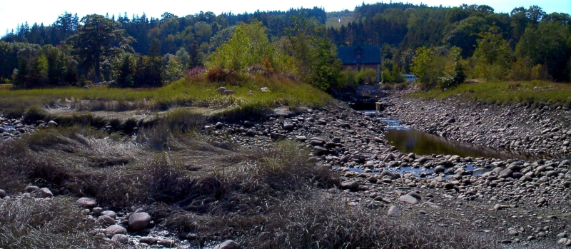
Not wanting to keep K longer than a day underfoot on the well-used wharf, I parked beside Fort Anne’s cemetery the second night. I didn’t find a secluded spot right off where I could make a fire, or even just park for a period of time, and I was so excited by all the things on my agenda for the area that I didn’t spend much time looking for one. But then, on my list of things to find was the 17th century mill site, up a ways on the Allain creek which was the southern boundary of town. The Allain Creek split off from the Annapolis River, and at the base of the foothill, rose and forked off into a “Y”. The left side went straight up to a tiny bridge that united the two roads that ran along either side of the creek, and the right side veered off to another point higher up the foothills where the first French grist mill had been built for the new settlers by the first colonial governor, Poutrincourt. There was a small memorial park there, with a re-creation of the mill and a pond at the base of the small mountain ridge, and a lovely manicured flower garden and plaque centered around the original millstone, positioned like a sculpture, that Poutrincourt had brought back for the new colony from France in 1610. (I love how the Canadians love their millstones, dressing them up in gardens.)
.
The drive up rose steeply through a stretch of woods that blocked the view of Allain Creek to the left, but when I got to the top by the bridge and looked back down, it was dramatic. The creek was set into a scooped-out valley that was forested on all sides, shielded from view of any houses and roads. At the edge of the valley under the tree line, I could just make out the vaguely rectangular ring of stones that I’d read about in one of the many archaeology reports I’d xeroxed in Halifax. I looked for an access point through the heavily wooded rim of the valley and saw a raised bluff that stuck out into the middle of the valley where the 3 arms of the “Y” came together. The tiny trickle of the stony creek beneath the bridge I was standing on babbled invitingly down to a point just beneath the bluff, and I made a mental note to include shampoo in with the day’s back pack.
.
There was a parking pull-off by the millstone monument, and it was there that a once-used path, now overgrown with thorny brambles, led out to the point I’d seen. All it took was a few whacks with a machete to reach the point, marked by a large, nearly-submerged boulder that punctuated the bluff’s 20-ft drop-off, and there it was, my Port Royal campsite.
.
I put hip waders on, descended the bluff wall and trudged through the marshy valley floor to the cellar site, the walking much easier for not having to deal with the red clay deposits I had just come from.
Mostly, though, I spent the next few hours in the creek bed, communing with the snug little valley from a ring of stones around a little hollow that formed a recliner chaise so perfectly proportioned that I had to laugh out loud. The stones were smooth and clean and warm above the waterline, and after washing my hair and laying it back over the sun-warmed ‘pillow’ stone to dry, I set myself to a new paperback of Alistair MacLeod’s short stories. I must have fallen asleep because I was awakened by the sensation of water creeping up my foot that was considerably colder than the creek trickle that was flowing down my back from above. The book was soaked; got another. (Totally worth it! “Island” captures the stark beauty, social isolation, the extremes of nature and its tragedies, and the culture clash of traditional Nova Scotia in the 1950s. Dark, though; fair warning.)
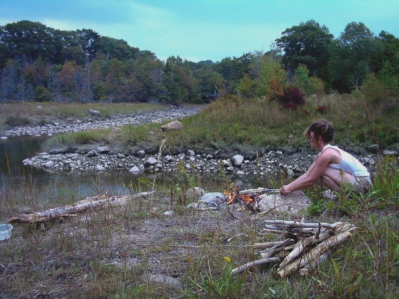
It was the perfect campsite, and that afternoon’s relaxation in the creek bed was the first of many such times spent there, just as the long-delayed scallop roast was the first of many.
.
It was a great campsite not only for its beauty, but also for a colorful country store just across the bridge a half-mile or so, with baskets of the day’s fresh produce stacked out front… pumpkins, corn and apples, cartons of peaches and nuts, shelves with jars of fresh honey and homemade jams, and flowering plants that Canadians are so hungry for during the few warm months they have. Inside, belying its seeming small size, there was everything imaginable for the deer hunter, the fisherman and camper, plus a grocery. And across the street, a gas pump. It was often my first stop of the day because it also had a fresh pot of hot coffee on every morning (that I’d add a squirt of my New Orleans ice coffee concentrate to), donair sandwiches for the day’s wanderings (a spicy beef gyro drizzled with a sugary cream sauce), and a man behind the counter named Thibodeau who I would tease and try to cajole into coming out with me to see his ancestral Thibodeau homesite. He had no knowledge of it and even less interest in the 1671 map of it, and he would only laugh and shake his head at me. It became a ritual.
.
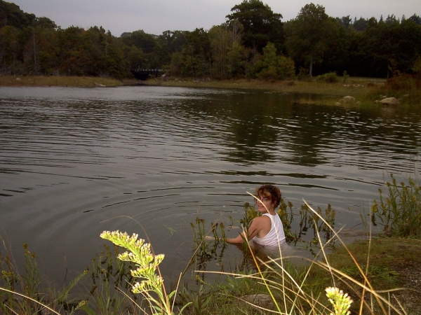
It was a campsite where I could do more than just experience the tides; I could take part in them, get in and swim, bathe, do dishes, and learn to time my activities to them as the Acadians did. I took to keeping the month’s tidal schedule pinned above my desk, mostly for when I wasn’t in Port Royal. Twice a month, for 2 days each time, high tide hit the Allain Creek valley between 3 and 5 pm, just after the heat of the day. On those days, I tried my best to get to Port Royal, and in time to swing by Digby first for some fresh scallops. Cuz on those days, just at the point when the tide started going out again, I took particular glee in barreling off the point as far out as I could stretch a dive, over and over as the receding water got lower and lower and ‘Diving Board Rock’ became more and more of a high dive. In between dives, I’d get the campfire built and the scallops ready in their grilling cage, and by the time the water got too low for me to know how much water was between my head and the rocky bottom, that was my cue to light the fire.
The only thing better than fresh scallops grilled in the open air is if they’re eaten with the kind of appetite that an afternoon like this creates.
.
_______________________
.

.
____________________________
End of Goodbye, K-Man (pg.3 of 4) . . . . . . . . . . . . . . . . . . proceed to pg.4 of 4 . . . . return to pg.2 . . . . go back to pg.1