(cont’d from pg.1 of 4 )
My 2nd-favorite campsite, it turned out, was where it all happened in 1755, the Grand Pre deportation site. The exact point where the British, after years of alternately trying to get the Acadians to swear allegiance to the British crown and trying to burn them out of house and home, finally put the settlers of Grand Pre on ships bound for, basically, the four winds, was thought to be a couple hundred yards up the railroad track, inland from my secluded riverside campsite.

.
.
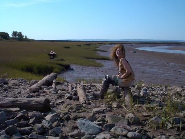
I had found a site on the Gaspereau River on the east side of the Grand Pre peninsula, far from any neighboring farmhouses, at a point where a lone tree sitting atop an equally lone mound of rocks overlooked the river. The water was heavy with the Fundy’s red clay, brought high up the river bed with the tide by a single wave they call a tidal bore that reverses the river’s current twice a day as the tide comes in and leaves a red clay mudflat rimmed in marsh grasses as the tide goes out. Shards of coke-bottle glass and pottery pointed to the place’s popularity for campfires, and I thankfully took my turn under the tree for several days.
As the tide went out, I began to see that the rocky patch of shoreline was actually the head of an old, abandoned log jetty that jutted out into the river. When the tide had all but disappeared, I put hipwaders on and ventured out into the red muck, where I saw that this decrepit cross-hatch of logs and rock fill, layers upon seaweed-draped layers, rose 15 ft off the bed of stones laid down on the mucky sea floor as its base… an old wharf at some point.

. . . . . . I walked inland up a nearby railroad track that penetrated the golden fields of Grand Pre and found the black iron cross erected in the 1920s to mark the site of the 1755 expulsion, back when the water’s edge was further inland than it was now.
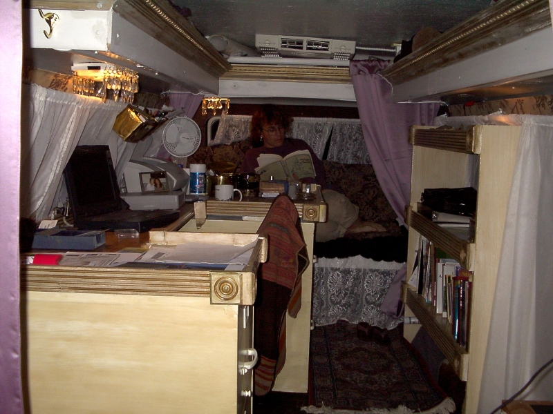
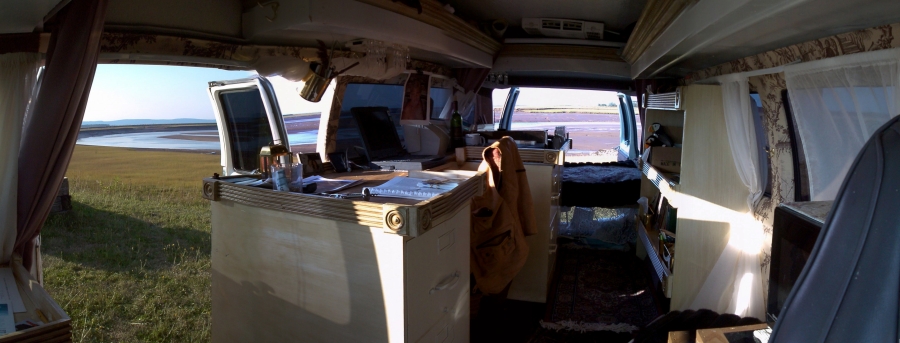
In August of that year, the men of Grand Pre were tricked into gathering at the church, then arrested, and eventually forced onto disastrously overloaded ships, their women and children having no choice but to follow, while all the possessions they’d been told they could take with them ended up having to be thrown overboard or left ashore… furniture, clothing and linens, pottery and iron pots, women’s spindles and looms, men’s tools, children’s toys, family pets. Of the 16,000 settlers who were expelled from Acadia during the years after 1755, around 4000 were deported from Grand Pre that September. But not from where they put that 1920s monument. Turns out, 5 years after my trip there, a young archaeologist I met at one of the universities in Halifax used aerial photography together with archaeology to establish that the actual site of the expulsion from Grand Pre was around the rocky remnants of that old wharf where I spent so many wonderful days pouring over new research materials and writing until late into the night, K’s doors open to the beautiful cool weather and sea breezes.
Day . . . . . . and night.
.
.
.
.
.
.
.
.
.
Finding a spot right on the edge of a red clay salt marsh was conducive to imagining how everyday life in the 17th century would have been affected by the tide. The tides are regular, 6 hrs & 12 minutes from high to low, 12 hrs & 24 minutes from high to high, and each day’s first tide coming 52 minutes later than the previous day’s. The church at Cobequid served the entire Minas Basin, which meant half the congregation had to cross the basin, and the priest would have had to schedule his Sunday mass with the tides, roughly 6 hours later, then earlier, alternating each week, to give those crossing the Basin enough time to both cross, hear mass, and cross back. You’d have to shift your whole mindset of time, from being centered on the sun to being centered on the tides.
From my campsite where the Gaspereau River opens out onto Cobequid Bay, I’d look out across the bay at low tide and I’d be looking at the bare sea floor for as far as the eye could see. How did Pierre Thibodeau and his hardy sons manage the long trip from Port Royal all the way across the Fundy to Chipoudy and have enough water for the whole trip? They would have taken off the minute the tide came in enough to lift them. Did they stop half way through at Beaubassin? Or was it a common occurrence for people to get stranded and simply ride out the cycle until the next tide carried you the rest of the way?
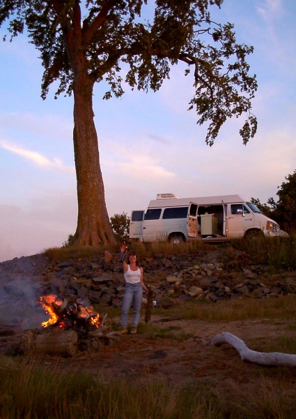
During one of the long walks along the shore collecting the day’s firewood, along with the plethora of ‘mermaid’s purses’ that have fascinated me since I was a child, I managed to haul a huge tree rootball over to the firesite. It made for the best fire of my whole 4 months in Nova Scotia. More like a bonfire, I couldn’t get near enough to it to cook on, but it made for a great photo to send back home as promised to the guys who did K’s RV conversion … especially the surly one who argued with me about my design every step of the way. “You’ve got to be the stubbornest woman I’ve ever met; I just might have to marry you.”
Late that night, I was startled awake by a horrendous hiss directly below my head that got steadily louder until it was like the roar of a jet engine just outside my door. I thought K was about to blow up, quickly contemplated what things I should take out with me on my way to the door, until I opened it and saw what was making such a horrendous noise. The tide had come in almost up to my feet and washed the rootball up with it where it bobbed and bumped into the bluff’s edge, still glowing red hot at its center, sizzling and roaring like a bullhorn.
.
.
Not every place I went was for its historical significance.
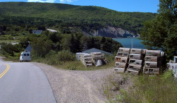
Cape Breton, the Cabot Trail in particular, has been known since the 1930s as a thrilling driver’s destination. It’s like riding a roller coaster with its wild ups and downs and hairpin turns, often overlooking cliffs that drop straight down into the Gulf of St. Lawrence. Making matters worse is the beauty of the valleys and creeks with elk and the occasional moose, the deep, clear, blue-green water, and the seals on the rocks far below, all of which lure your eyes away from the road at every turn.
At one point, the cliffside road dipped down to sea level where a low grassy hill gave way to a stone beach, cut through by a mountain stream that emptied out into the Gulf of St. Lawrence. I struck up a conversation with a lone canoer who was getting ready to put in, and when I asked about the seals, he invited me to join him for a turn out in the water which was freezing cold and a wonderful clear deep green.
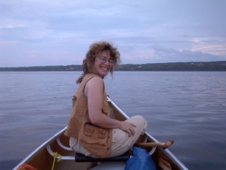
No seals, but what I found there in that cove was so much better. That night, having no tide to worry about, I pitched camp there on the stones. It was around midnight when I was done on the computer inside and ready for some fresh air. I knew the temperature was dropping but I was surprised by the cold that hit me when I opened the door. It was near freezing. I was also surprised by how clearly visible everything was, though I couldn’t see a moon, with every tree on the hill and contour on the trees, nearly every blade of grass crystal clear in rich luminous blues. I put layers of sweatsuits on under a heavy coat, covered head and hands, and went out onto a stone surface that ordinarily would have sent me, after only a few steps in the dark, to the ground with a twisted ankle, except that tonight I could see every surface, every contour, every stone, in a light that somehow seemed computer-altered… as though I were on something good, and I mean something good. But the sky… the whole milky way was spread out over my head. I brought out my folding lounger and feather comforter, set it up on a smooth patch near where the stream bed fanned out into the open sea, and then stretched out flat. There were more stars in the sky than I’d ever seen. I saw them with more clarity and depth of field than I ever had, and lost myself for an hour, maybe two, inside the shapes and patterns and constellations that poured out across the sky. I must have fallen asleep, because I remember waking up with a burning sensation on the top of my head where my hat had fallen off. Little ice crystals covering the surface of the comforter, and icicles hung from the corners by my feet. Maybe those of you who don’t live under city lights or swamp vapors think I’m over-reacting, but to me it ranks right up there with a religious experience.
.
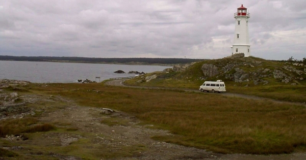
As if K and I hadn’t communed with nature enough, as fate would have it, my next stop was Fort Louisbourg on the opposite side of Cape Breton, on the stark stone shelf that is the east coast up there. That’s where I was when I heard news of the gale. I headed for an unpopulated stretch of coastline and found a patch of stony shelf where I could back K up to the ocean. Minus hills, trees, or even soil, and a good bit warmer, it couldn’t have been more opposite from my starry cove.

.
.
.
.
.
.
In the middle of the night, I was awakened by the jolt of a wave slamming into the back door about 5 inches from my face, then after a few seconds’ delay, coming back down again with a thud on the roof, trickling down the windows on all sides of me. It continued in regular intervals until its escalation made the intervals overlap, even running into each other, rocking the van back and forth. How I yearned for just a little light, enough to take a picture by, but there was none. At some point, I decided to strip down and go out into it with a bar of soap for a shower. Not so easy. I could have used 3 arms; one to hold the soap, one to hold onto the door handle, and one to hold my nose each time a wave slammed into me.
Something told me to keep hold of the door handle with whatever hand didn’t have the soap in it, but I wouldn’t realize until daylight how easily I could have been pulled out to sea. I’m not sure but what the whole van could have been sucked out.
Never felt anything like it. (Lotta that goin’ around.)
.
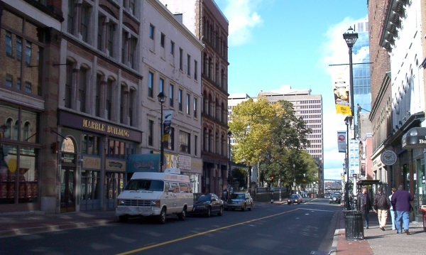
And of course there was the tiny gem, Halifax, with her universities, museums and research facilities that I was given great access to, thanks to a couple of fun tours and bar hops I took a few lecturers on a few years before, back when they were in New Orleans for an archaeology convention. Never underestimate the value of a good Bourbon St. drunk in the time-honored system of social reciprocity. Also, Halifax is the only place in Nova Scotia for computer equipment and repair, printer ink, photo paper, etc. My first night there, I stayed outside the Ceilidh internet cafe. Strange and wonderful, being naked and asleep in a comfy bed in the middle of downtown, in complete secret from people walking by just two feet from my head.


. . . . . . . . . The next day, though, I discovered a spot above the 18th century Citadel and harbor, between Halifax’ Public Gardens, a lovely formal Victorian garden from the 1860s with ponds and gazebos and bridges and fountains, and the historic 1840s Camp Hill Cemetery with its manicured marble monuments amidst the trees.
.
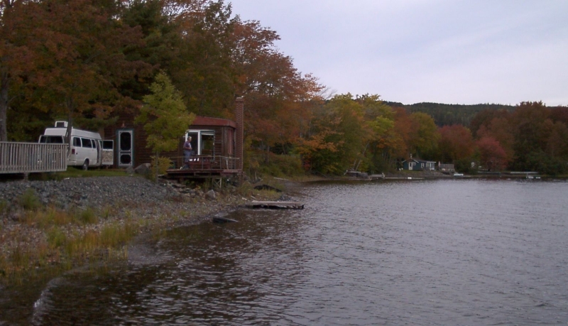
Lochaber lake is a remote mountain lake that is 5 miles long, nearly 200 ft deep, much like the Scottish highlands, and looks like, well… this.
My canoeing friend had a log cabin with a wood stove that looked like one of those Easter Island stone heads and a pair of loons that held court over this part of the lake. Much like Halifax, I made several visits here as the summer progressed and got to see the loons’ baby grow from a tiny fuzz ball into a smaller, more mottled version of its parents. Ah… and the sound of their cry, wafting across the lake.
.
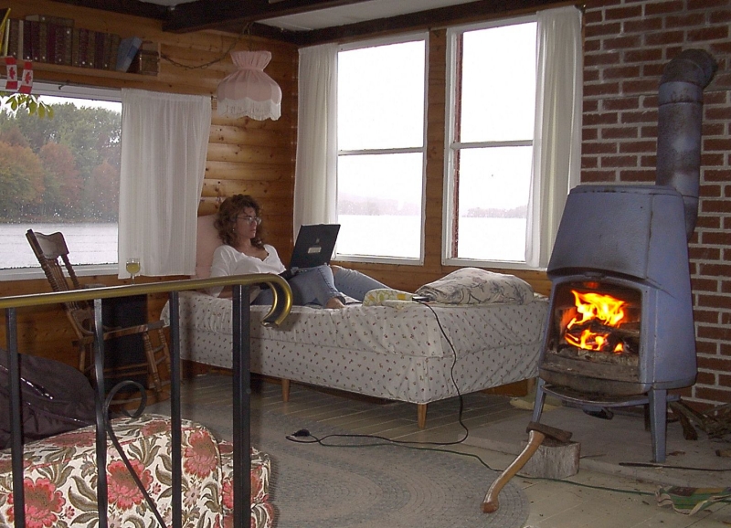
I don’t know how happy K was about this place, but it had a small kitchen, and there are a few things I can’t do in K. Once, a friend’s neighbor, who knew of New Orleans’ reputation for cooking, asked me if I would like a haunch of bear to cook (would I!). I had a ball with it. Actually, the same thing happened the following summer, only with moose instead of bear. (Wanna know what I did? Covered it completely in liquid, half red wine, half Campbell’s beef consomme [not a drop of water!], salt and pepper and tons of chopped onions, brought it all to a boil, then simmered it for 4 hours. The toughest meat will fall off the bone ‘like budduh’. To be more explicit: – Sear the roast in a bit of vege oil thoroughly, then remove to the side. Use a pot that’s only a little bit bigger than the roast. Add a half stick of butter and saute 3-4 cups chopped onions. When well wilted, you can put the roast and the liquids back in, along with as many mushrooms as you can fit, and bring it all to a boil. Then reduce the heat to a tiny simmer for 4-6 hours.) Now this is a place that could give K’s little nest of a workplace a run for its money, though I would never tell him that.
.
.
And then there was Digby, which had scallops, the largest ocean-going scallop fleet in the world, where I planned to stock up on fresh scallops right off the boat. I first arrived at night with no campsite planned, so I parked in a parking lot overlooking the marina. I found an honest-to-God bar with live music and enjoyed a bourbon and coke for a change, in the company of people for a change. (There’s no Jack Daniels here, only Crown Royal. These people love their Crown Royal. One snooker club a friend introduced me to ordered a bottle of Jack especially for me, and when I returned the following summer, the bottle hadn’t been touched since I’d left.)

When I woke up, I had an uninterrupted view of the North Mountains miles across the Annapolis Basin and all I could see of the previous night’s marina were the topmost tips of a bunch of masts. The pier had fallen away completely. I got out, looked out over the seawall, and found the marina from the previous night; boats, piers, slips and all, sitting on the seafloor 20 ft below. I was back on the Fundy.
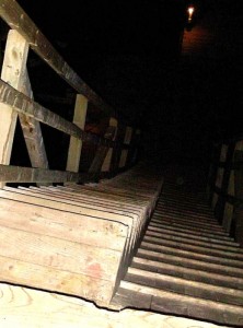
The gangplank from the parking lot onto the piers, horizontal the night before, turned out to be a flat walkway only up one side of it, while a stairway went along the other. Metal loops off the sides and ends of each pier were looped around poles set firmly into the sea floor, and the pier floated up and down, firmly in place, as the Fundy did its thing. But there were clear puddles on the kelp-draped sea floor. Where was the red clay? The Annapolis Basin, where the main Acadian settlement took form, shoots off from the Fundy very near where the cold clear ocean waters first flow into the Bay of Fundy, apparently before they reach the red clay deposits that are then carried up and over the whole upper Fundy and its tributaries.
Another thing this pier had? It had a strip of retail seafood huts and houses next to it that extended from the parking lot to the far side of the harbor where I could see scallop boats that looked alot like our shrimp boats, only 3 times that size. A walk down the peculiar stepped walkway to the pier led mostly past modern fiberglass sailboats and pleasure craft, but some of them were old; old-fashioned it seemed to me, heavy and hand-hewn and strange to me. One of them had a guy in his 60s in it, puttering around with an outboard. Knowing how many types and shapes of boats men in the Atchafalaya Basin use for different uses, I asked him if the style were meant to serve something particular about the ecosystem here, but he looked at me blankly and could only tell me what kind of fish he caught.
Before leaving Digby, I stopped by one of the seafood places and bought fresh scallops enough to choke a horse, as many as could fit the small freezer section of my fridge since I didn’t know when I would next be able to cook outdoors, and then I drove up the wooded hills to a restaurant for a delicious Coquilles St. Jacques, the only restaurant I went to in Nova Scotia that made me put my long velvet dress on for it. K was duly impressed. The restaurant was in a grand old 1929 resort, built in the style of a Norman Chateau on the outside whose lobby on the inside looked for all the world like the hotel in the movie “The Shining”. Red rum, red whiskey, red clay… (except here it’s not red clay)
.
And this, of course, leads me to the other side of the Annapolis Basin, the 17th century Dauphin River and Port Royal, the high point and raison d’etre of K’s and my sojourn.
.
. End of Goodbye, K-Man (pg.2 of 4) . . . proceed to pg.3 . . . skip to pg.4 . . . return to pg.1
______________________________
